2017
TL4279 : The Causeway, Sutton Gault
taken 7 years ago, near to Mepal, Cambridgeshire, England
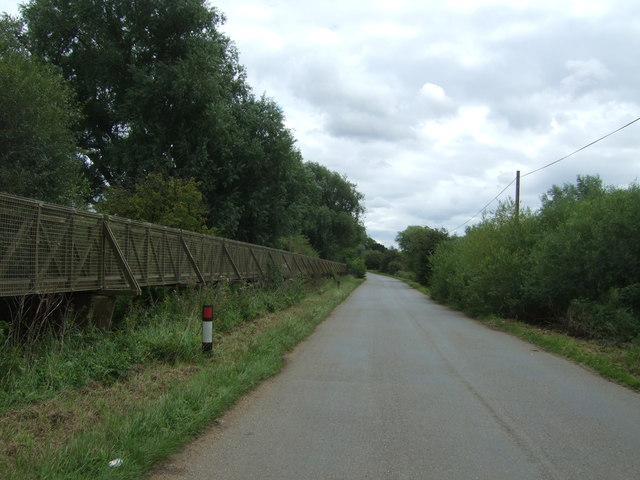
The Causeway, Sutton Gault
Low lying land, prone to flooding. Note the elevated walkway for use in times of flood.
 Map © Crown Copyright")
TIP: Click the map for more Large scale mapping
- Grid Square
- TL4279, 117 images (more nearby 🔍)
- Photographer
- JThomas (more nearby)
- Date Taken
- Saturday, 12 August, 2017 (more nearby)
- Submitted
- Monday, 14 August, 2017
- Subject Location
-
OSGB36:
 TL 426 797 [100m precision]
WGS84: 52:23.8256N 0:5.7089E - Camera Location
-
OSGB36: TL 426 797
- View Direction
- Southeast (about 135 degrees)