2017
NT5918 : Motte near the Rule Water
taken 7 years ago, near to Bedrule, Scottish Borders, Scotland
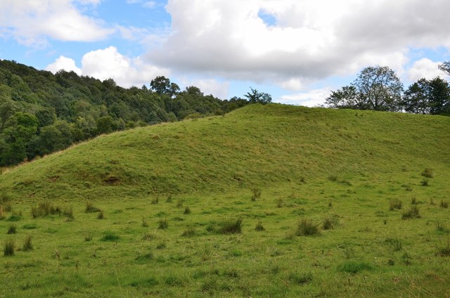
Motte near the Rule Water
Marked as an ancient site on the 1:25,000 map, this lies on the west bank of the Rule Water NW of the village.
 Map © Crown Copyright")
TIP: Click the map for more Large scale mapping
- Grid Square
- NT5918, 14 images (more nearby 🔍)
- Photographer
- Jim Barton (more nearby)
- Date Taken
- Tuesday, 15 August, 2017 (more nearby)
- Submitted
- Wednesday, 16 August, 2017
- Subject Location
-
OSGB36:
 NT 5951 1826 [10m precision]
WGS84: 55:27.3904N 2:38.5078W - Camera Location
-
OSGB36: NT 5945 1829
- View Direction
- East-southeast (about 112 degrees)