TQ3280 : View towards the Shard
taken 7 years ago, near to Bermondsey, Southwark, England
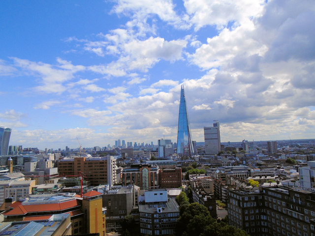
A 72-storey office building and hotel, constructed from 2009-2012 as the centre of the London Bridge Quarter development on the South bank of the Thames. The skyscraper is, at 310m tall, for a while the tallest building in the European Union and the 45th tallest building in the world. It is the second tallest free-standing structure in the United Kingdom after the 1,084 ft (330.4m) Emley Moor transmitting station.
The tower was designed by Italian architect Renzo Piano, and cost £450 million. The Government of Qatar financed the building and its Prime Minister declared it open on 5 July 2012. It opened to the public in February 2013.
For views of and from the Shard after opening, see Link
The official website is Link
See also the Wikipedia entry at Link
Guy's Hospital is a large NHS hospital in Central London. It is administratively a part of Guy's and St Thomas' NHS Foundation Trust. It is a large teaching hospital and is, with St. Thomas' Hospital and King's College Hospital. The Tower Wing (formerly known as Guy's Tower) is the tallest hospital building in the world, standing at 142.6m, with 34 floors. The hospital was founded in 1721 by Thomas Guy.
Website: Link
 Map © Crown Copyright")
- Grid Square
- TQ3280, 6515 images (more nearby 🔍)
- Photographer
- Paul Gillett (more nearby)
- Date Taken
- Saturday, 19 August, 2017 (more nearby)
- Submitted
- Saturday, 19 August, 2017
- Subject Location
-
OSGB36:
 TQ 3293 8016 [10m precision]
WGS84: 51:30.2849N 0:5.1662W - Camera Location
-
OSGB36: TQ 32096 80429
- View Direction
- East-southeast (about 112 degrees)