2007
SD9875 : Tor Dike
taken 17 years ago, 3 km from Starbotton, North Yorkshire, England
This is 1 of 3 images, with title Tor Dike in this square
Tor Dike
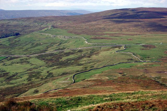
Tor Dike is an earthwork north of Kettlewell with ditch and rampart constructed in the limestone. Tor Dike was built by Iron Age tribes, probably 1st century AD, to protect themselves from the invading Romans.
In this picture the Dike follows the line of the wall and crosses the road coming up from Kettlwell on its way to Wensleydale. To the right the slopes of Buckden Pike rise gradually.
In this picture the Dike follows the line of the wall and crosses the road coming up from Kettlwell on its way to Wensleydale. To the right the slopes of Buckden Pike rise gradually.
 Map © Crown Copyright")
TIP: Click the map for more Large scale mapping
- Grid Square
- SD9875, 31 images (more nearby 🔍)
- Photographer
- John Harvey (more nearby)
- Date Taken
- September 2007 (more nearby)
- Submitted
- Monday, 10 September, 2007
- Subject Location
-
OSGB36:
 SD 984 756 [100m precision]
WGS84: 54:10.5980N 2:1.5146W - Camera Location
-
OSGB36: SD 994 754
- View Direction
- West-northwest (about 292 degrees)