2017
TA1128 : Humber Estuary
taken 7 years ago, near to Marfleet, Kingston Upon Hull, England
This is 1 of 124 images, with title Humber Estuary in this square
Humber Estuary
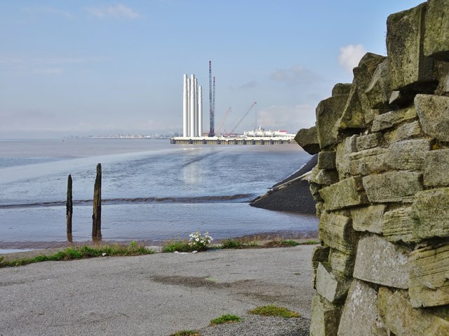
Together with development partner Associated British Ports, Siemens is investing in offshore wind turbine production at Alexandra Dock. Further information: Link
The derelict piers are at the outfall of Holderness Drain into the Humber estuary, between Alexandra and King George Docks.
At right, part of a near-circular stone structure. Affixed to various stones are plates with the names of places and their distance from Kingston upon Hull in nautical miles. Places include those twinned with the city: Szczecin, Poland, Freetown, Sierra Leone, Raleigh, North Carolina. Nearer to home are plates for Grimsby and Scunthorpe.
 Map © Crown Copyright")
TIP: Click the map for more Large scale mapping
- Grid Square
- TA1128, 507 images (more nearby 🔍)
- Photographer
- Bernard Sharp (more nearby)
- Date Taken
- Saturday, 2 September, 2017 (more nearby)
- Submitted
- Sunday, 3 September, 2017
- Subject Location
-
OSGB36:
 TA 1183 2852 [10m precision]
WGS84: 53:44.4646N 0:18.3553W - Camera Location
-
OSGB36: TA 1316 2866
- View Direction
- WEST (about 270 degrees)