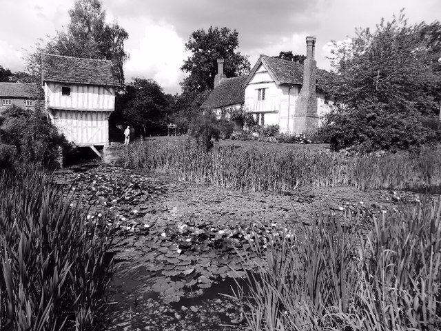
SO6855 : Lower Brockhampton
taken 7 years ago, near to Bromyard Downs, County of Herefordshire, England
Compiled by Brian Robert Marshall
The Brockhampton Estate centred on Lower Brockhampton is a National Trust property and has been since 1946 when it was bequeathed to the Trust by the last owner Colonel John Lutley. It was and remains a working farm and the ancient buildings were occupied as late as the 1980s. The two main buildings are the farmhouse and the gatehouse which date to the 14th and 16th centuries respectively. In 2010 the farmhouse was comprehensively restored following earlier restoration and repair programmes in 1871, 1947 and the 1990s Link
The gatehouse has also recently been restored.
The third building of interest is the ruin of a Norman chapel used for storage purposes from the late 18th century until the 1980s.
The farmhouse is listed Grade I Link
The chapel is Grade II* Link
 Map © Crown Copyright")
- Grid Square
- SO6855, 143 images (more nearby 🔍)
- Photographer
- Philip Halling (more nearby)
- Date Taken
- Friday, 1 September, 2017 (more nearby)
- Submitted
- Monday, 4 September, 2017
- Subject Location
-
OSGB36:
 SO 6875 5597 [10m precision]
WGS84: 52:12.0640N 2:27.5197W - Camera Location
-
OSGB36: SO 6877 5594
- View Direction
- North-northwest (about 337 degrees)