2017
NU0943 : Walking to Lindisfarne
taken 7 years ago, 3 km from Beal, Northumberland, England
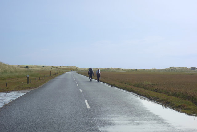
Walking to Lindisfarne
Two hikers have reached the dunes on the west side of Holy Island after crossing the Causeway.
 Map © Crown Copyright")
TIP: Click the map for more Large scale mapping
- Grid Square
- NU0943, 115 images (more nearby 🔍)
- Photographer
- Des Blenkinsopp (more nearby)
- Date Taken
- Thursday, 24 August, 2017 (more nearby)
- Submitted
- Thursday, 7 September, 2017
- Subject Location
-
OSGB36:
 NU 0940 4307 [10m precision]
WGS84: 55:40.8616N 1:51.1247W - Camera Location
-
OSGB36: NU 0927 4303
- View Direction
- East-northeast (about 67 degrees)