2017
SE8457 : Bollard on the top of Huggate Wold
taken 7 years ago, 4 km SW of Fridaythorpe, East Riding of Yorkshire, England
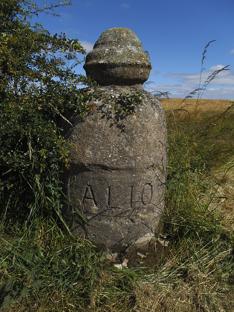
Bollard on the top of Huggate Wold
See SE8457 : Road along the top of Huggate Wold for context. I would have called it a boundary stone, but Christopher Hall describes it as a concrete bollard SE8457 : Detail of bollard at field entrance and provides an explanation, although the inscription "ALIO" remains a mystery.
 Map © Crown Copyright")
TIP: Click the map for more Large scale mapping
- Grid Square
- SE8457, 25 images (more nearby 🔍)
- Photographer
- Stephen Craven (more nearby)
- Date Taken
- Saturday, 8 July, 2017 (more nearby)
- Submitted
- Sunday, 10 September, 2017
- Subject Location
-
OSGB36:
 SE 8489 5706 [10m precision]
WGS84: 54:0.1560N 0:42.3818W - Camera Location
-
OSGB36: SE 8489 5706
- View Direction
- WEST (about 270 degrees)