2017
NZ0541 : Moorland with rushes above Tunstall Reservoir
taken 7 years ago, 4 km S of Waskerley, County Durham, England
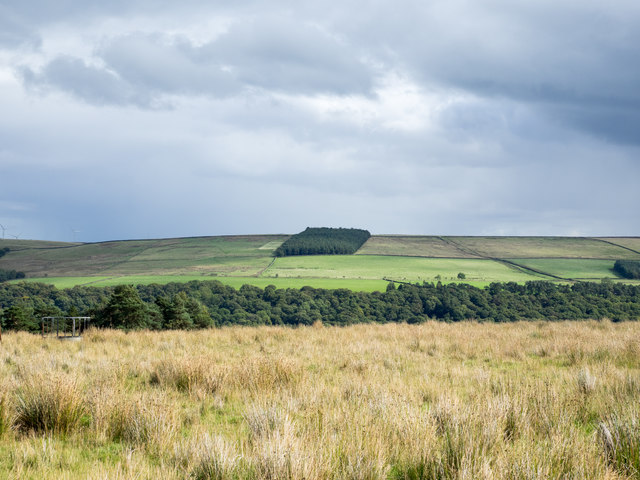
Moorland with rushes above Tunstall Reservoir
The enclosure of moorland lies above the west side of Tunstall Reservoir in the valley of the Waskerley Beck. The coniferous block and enclosures in the distance are above the east side of the reservoir which is in the valley below, unseen.
 Map © Crown Copyright")
TIP: Click the map for more Large scale mapping
- Grid Square
- NZ0541, 3 images (more nearby 🔍)
- Photographer
- Trevor Littlewood (more nearby)
- Date Taken
- Tuesday, 12 September, 2017 (more nearby)
- Submitted
- Tuesday, 12 September, 2017
- Subject Location
-
OSGB36:
 NZ 0526 4152 [10m precision]
WGS84: 54:46.1148N 1:55.1860W - Camera Location
-
OSGB36: NZ 0534 4151
- View Direction
- WEST (about 270 degrees)