2017
NU1042 : Pilgrim's Way refuge
taken 7 years ago, near to Holy Island, Northumberland, England
This is 1 of 2 images, with title Pilgrim's Way refuge in this square
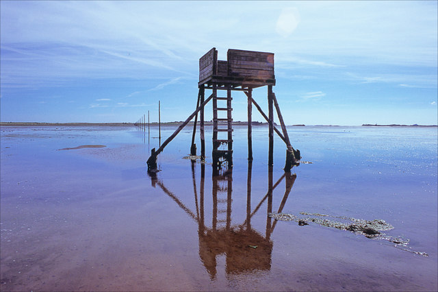
Pilgrim's Way refuge
The second refuge on the Pilgrim's Way. This is a path that crosses the sands at low tide, the way is marked by poles. The refuges are places of shelter in case the tide comes in - the boxes remain above water even at high tide.
 Map © Crown Copyright")
TIP: Click the map for more Large scale mapping
- Grid Square
- NU1042, 29 images (more nearby 🔍)
- Photographer
- ron layters (more nearby)
- Date Taken
- Thursday, 10 August, 2017 (more nearby)
- Submitted
- Thursday, 14 September, 2017
- Subject Location
-
OSGB36:
 NU 1023 4270 [10m precision]
WGS84: 55:40.6612N 1:50.3336W - Camera Location
-
OSGB36: NU 1012 4275
- View Direction
- East-southeast (about 112 degrees)