2017
TF8200 : Entering Hilborough on the A1065 Brandon Road
taken 9 years ago, near to Hilborough, Norfolk, England
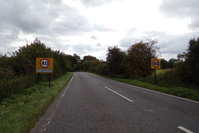
Entering Hilborough on the A1065 Brandon Road
Hilborough, Norfolk
Hilborough is a village and a civil parish in the county of Norfolk.The village is 5.5 miles south of Swaffham, 25.4 miles west south west of Norwich and 93.2 miles north north east of London. The population of the parish (including Bodney) at the 2011 Census was 243. The village straddles the A1065 between Swaffham and Brandon.The nearest railway station is at Brandon for the Breckland Line which runs between Cambridge and Norwich.
A1065 Road (provided by N Chadwick)
The A1065 is an important route through the centre of Norfolk. It starts on the infamous Five Ways roundabout at Barton Mills, leaving the A11, and heads up through countryside for nearly 40 miles, crossing the A47 at Swaffham en route, until it ends on the A148 just outside Fakenham.
Geographical Context:
Village, Rural settlement
Roads, Road transport
Entering:
Hilborough
At:
Hilborough
On:
The A1065 Brandon Road
Road:
A Road
A1065
Primary Subject:
Road
other tags:
Hilborough
Hilborough Village Name Sign
Village Name Sign
A1065 Brandon Road
A Road (Classified A)
A1065
Brandon Road
Click a tag, to view other nearby images.
This photo is linked from:
Automatic Clusters:
· A1065 in Hilborough [15]
· A1065 Brandon Road [8]
·
- Grid Square
- TF8200, 86 images (more nearby 🔍)
- Photographer
- Geographer (more nearby)
- Date Taken
- Tuesday, 19 September, 2017 (more nearby)
- Submitted
- Friday, 29 September, 2017
- Subject Location
-
OSGB36:
TF 82942 00829
[1m precision]
WGS84: 52:34.4702N 0:41.8963E - Camera Location
-
OSGB36:
TF 82946 00831
- View Direction
- Southwest (about 225 degrees)
