2017
SX8273 : Barn, Higher Staplehill
taken 7 years ago, near to Liverton, Devon, England
This is 1 of 2 images, with title Barn, Higher Staplehill in this square
Barn, Higher Staplehill
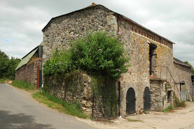
A slightly more complete view of the listed barn Link shown in SX8273 : Barn, Higher Staplehill. "Just below the eaves on the east, farmyard front is a pigeon loft formed by a long horizontal opening with timber lintel and sill filled at narrow intervals with 3 courses of bricks in blocks, the spaces are access for the birds. ... To the ground floor are 3 semicircular openings with finely-cut Devon limestone voussoirs". I hope that buddleia isn't doing irreparable damage.
 Map © Crown Copyright")
TIP: Click the map for more Large scale mapping
- Grid Square
- SX8273, 54 images (more nearby 🔍)
- Photographer
- Derek Harper (more nearby)
- Date Taken
- Friday, 7 July, 2017 (more nearby)
- Submitted
- Tuesday, 3 October, 2017
- Subject Location
-
OSGB36:
 SX 8253 7369 [10m precision]
WGS84: 50:33.0680N 3:39.5696W - Camera Location
-
OSGB36: SX 8253 7368
- View Direction
- NORTH (about 0 degrees)