2017
ST5281 : Scrubland by the Severn Estuary
taken 7 years ago, 3 km from Hallen, South Gloucestershire, England
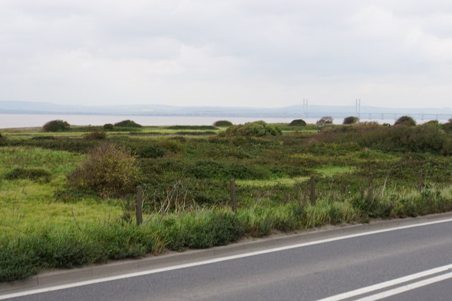
Scrubland by the Severn Estuary
Smoke Lane crossing the railway gives a little more height to this view. The land is unoccupied having had former industrial use. The M4 crossing of the Severn is in the distance.
 Map © Crown Copyright")
TIP: Click the map for more Large scale mapping
- Grid Square
- ST5281, 33 images (more nearby 🔍)
- Photographer
- Bill Boaden (more nearby)
- Date Taken
- Wednesday, 27 September, 2017 (more nearby)
- Submitted
- Wednesday, 4 October, 2017
- Subject Location
-
OSGB36:
 ST 5263 8114 [10m precision]
WGS84: 51:31.6304N 2:41.0533W - Camera Location
-
OSGB36: ST 5267 8108
- View Direction
- Northwest (about 315 degrees)