2017
SK0483 : The view from Chinley Churn
taken 7 years ago, near to Chinley Head, Derbyshire, England
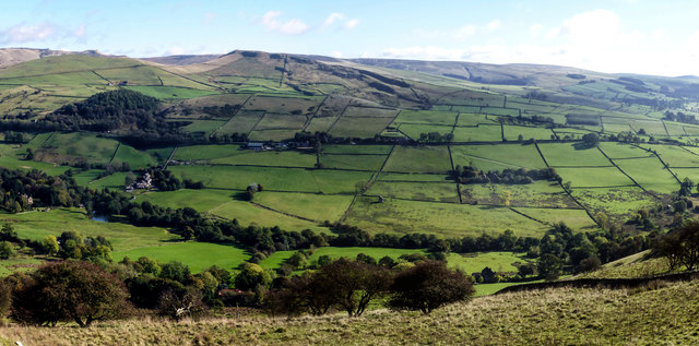
The view from Chinley Churn
Looking NW over the Otter Brook valley towards Mount Famine and the Kinder plateau
 Map © Crown Copyright")
TIP: Click the map for more Large scale mapping
- Grid Square
- SK0483, 19 images (more nearby 🔍)
- Photographer
- Graham Hogg (more nearby)
- Date Taken
- Friday, 6 October, 2017 (more nearby)
- Submitted
- Sunday, 8 October, 2017
- Subject Location
-
OSGB36:
 SK 0415 8381 [10m precision]
WGS84: 53:21.0697N 1:56.3472W - Camera Location
-
OSGB36: SK 0383 8366
- View Direction
- East-northeast (about 67 degrees)