2017
SJ9687 : Floodgates Cottage
taken 7 years ago, near to Marple, Stockport, England
This is 1 of 3 images, with title Floodgates Cottage in this square
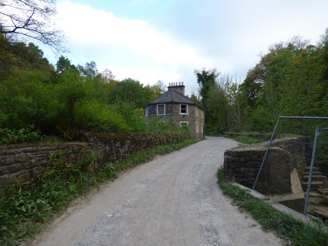
Floodgates Cottage
The Grade II listed building Link was built for Samuel Oldknow in 1801. It originally comprised two cottages. One was occupied by the tollkeeper as the road was at the time a major route through the valley. The other was occupied by the sluiceman who operated the sluices which allowed water from the River Goyt to flow into Roman Lakes. The lakes provided water for Mellor Mill which prior to being destroyed by fire in 1892 was the largest cotton spinning mill in England. In the early 1900s the cottages were used as tearooms.
Steps to the sluicegates SJ9687 : Sluice gates by the river Goyt can be seen on the right.
Steps to the sluicegates SJ9687 : Sluice gates by the river Goyt can be seen on the right.
River Goyt
The Goyt rises on the moors of Axe Edge, near the Cat and Fiddle Inn. It runs from the Errwood and Fernilee reservoirs, north of Buxton to Stockport where it joins the River Tame Link to form the Mersey.
It is also fed by the River Etherow which flows from the Woodhead reservoirs and joins near Marple Bridge, the River Sett which joins at New Mills and Todd Brook which joins at Horwich End.
 Map © Crown Copyright")
TIP: Click the map for more Large scale mapping
- Grid Square
- SJ9687, 126 images (more nearby 🔍)
- Photographer
- Gerald England (more nearby)
- Date Taken
- Monday, 8 May, 2017 (more nearby)
- Submitted
- Wednesday, 11 October, 2017
- Subject Location
-
OSGB36:
 SJ 9683 8758 [10m precision]
WGS84: 53:23.1033N 2:2.9474W - Camera Location
-
OSGB36: SJ 9684 8762
- View Direction
- South-southwest (about 202 degrees)