Geograph - photograph every grid square
2017
NY6777
: The River Irthing
taken
7 years ago
, 3 km from
Butterburn
, Cumbria, England
This is 1 of
2 images, with title The River Irthing
in this square
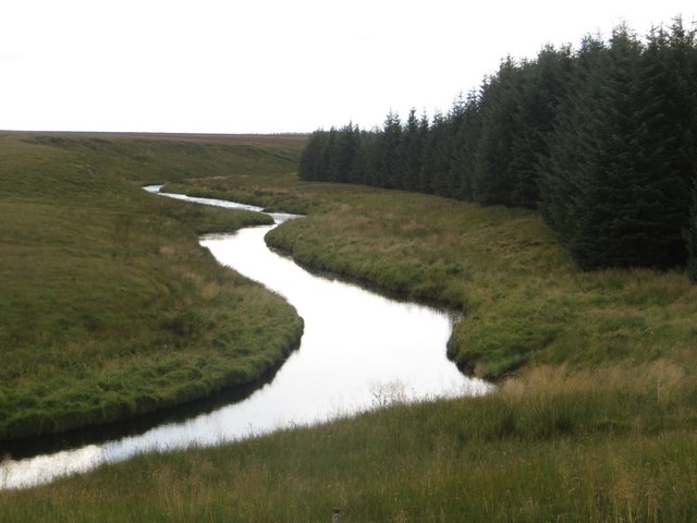
The River Irthing
The River Irthing, flowing close to the edge of a block of trees of Wark Forest.
© Copyright
Graham Robson
and licensed for
reuse
under this
Creative Commons Licence
.
Licensing
Download
More Sizes
Share...
Share this photo via Twitter
Share this photo via Facebook
Share this photo via Pinterest
Share this photo via Flipboard
Share this photo via email/e-card
Grab a Stamped/Watermarked Image
Mark
👍🏻
Like Image
👍🏻
Like Description
Update Information
Contact Contributor
Geographical Context:
Rivers, Streams, Drainage
River:
Irthing
This photo is linked from:
Automatic Clusters
: ·
Close [2]
Title Clusters
: ·
The River Irthing [2]
·
TIP: Click the map for more Large scale mapping
Grid Square
NY6777
, 16 images (
more nearby
🔍
)
Photographer
Graham Robson
(
more nearby
)
Date Taken
Sunday, 13 August, 2017 (
more nearby
)
Submitted
Sunday, 15 October, 2017
Subject Location
OSGB36:
NY 6711 7729
[10m precision]
WGS84:
55:5.3368N
2:31.0094W
Camera Location
OSGB36:
NY 6711 7735
View Direction
SOUTH (about 180 degrees)
NW
N
NE
W
Go
E
SW
S
SE
Discuss NY6777
View this location on ...
Geograph Coverage Map (includes OSM etc)
Geograph Links Page
Open in Google Maps
Navigate to location with Google Maps
Open in Google Earth Pro
Open in Google Earth for Web
Open in Bing Maps
Navigate with Google Maps
Lookup nearest Postcode
Image Type
(about)
:
geograph
This page has been
viewed
about
17
times
☰
Home
View
Search
Marked Images
Maps
Browser
Explore
Showcase
New Images
Collections
Interact
Games
Discussions
Blog
Contributors
Submit
Statistics
Leaderboards
General
FAQ
Help Pages
Sitemap
Contact Us
Support Us
sponsored by
🔍
What to search:
Photos
Enter keywords or a location/postcode to search nearby images
Photos near NY6777
Enter a Grid Reference
Placenames
Collections
Website Pages
Everything
Others:
Advanced Search
|
Image Browser
Or:
Coverage Map
|
Searchable Map
You are not logged in
login
|
register