2017
SD7097 : Old Milestone by the A683, Cautley Road, Narthwaite
taken 9 years ago, near to Low Haygarth, Cumbria, England
This is 1 of 4 images, with title starting with Old in this square
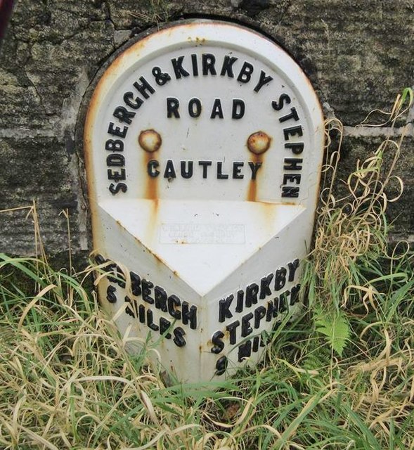
Old Milestone by the A683, Cautley Road, Narthwaite
Metal plate attached to stone post by the A683, in parish of Sedbergh (South Lakeland District), Cautley Road, ⅔ mile South of bridge over River Rawthey, in south end of retaining wall, on East side of road. WR iron casting, erected by the County Council in the 19th century.
Inscription reads:-
: SEDBERGH / 5 MILES : : SEDBERGH & KIRKBY STEPHEN / ROAD / CAUTLEY : : KIRKBY STEPHEN / 9 MILES :
Maker:-
: WILLIAM TOWLER / GLOBE FOUNDRY / - LEEDS - :
Grade II listed. List Entry Number: 1384110
Link (Archive Link )
Milestone Society National ID: YW_SBKS05.
Inscription reads:-
: SEDBERGH / 5 MILES : : SEDBERGH & KIRKBY STEPHEN / ROAD / CAUTLEY : : KIRKBY STEPHEN / 9 MILES :
Maker:-
: WILLIAM TOWLER / GLOBE FOUNDRY / - LEEDS - :
Grade II listed. List Entry Number: 1384110
Link
(Archive Link ) Milestone Society National ID: YW_SBKS05.
National Survey of Wayside Features by The Milestone Society
These images are from Link


TIP: Click the map for more Large scale mapping
- Grid Square
- SD7097, 41 images (more nearby 🔍)
- Photographer
- Milestone Society (more nearby)
- Date Taken
- Sunday, 8 October, 2017 (more nearby)
- Submitted
- Thursday, 19 October, 2017
- Subject Location
-
OSGB36:
 SD 70438 97303
[1m precision]
WGS84: 54:22.2224N 2:27.3918W - Camera Location
-
OSGB36:
SD 70438 97303
- View Direction
- East-southeast (about 112 degrees)


