2017
SD8241 : The view down to Upper Black Moss Reservoir
taken 7 years ago, near to Barley, Lancashire, England
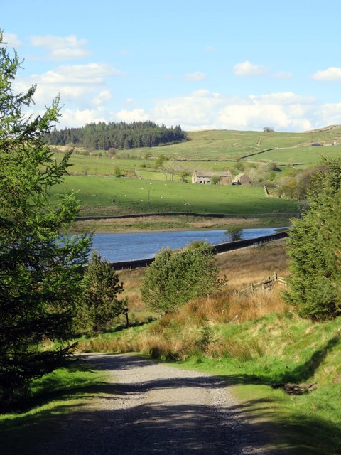
The view down to Upper Black Moss Reservoir
 Map © Crown Copyright")
TIP: Click the map for more Large scale mapping
- Grid Square
- SD8241, 43 images (more nearby 🔍)
- Photographer
- Steve Daniels (more nearby)
- Date Taken
- Friday, 5 May, 2017 (more nearby)
- Submitted
- Thursday, 26 October, 2017
- Subject Location
-
OSGB36:
 SD 8287 4149 [10m precision]
WGS84: 53:52.1600N 2:15.7194W - Camera Location
-
OSGB36: SD 8289 4127
- View Direction
- NORTH (about 0 degrees)