2017
J3474 : Laganside buildings, Belfast (October 2017)
taken 6 years ago, near to Belfast, Co Antrim, Northern Ireland
Laganside buildings, Belfast (October 2017)
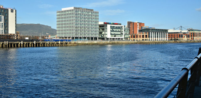
Almost 20 years of harbour/Laganside redevelopment evident in this view from Queens Quay. City Quays Link (Donegall Quay, current, left) and Beacon House (Clarendon Dock) Link (right, started in 1998).
City Quays, Belfast
A large-scale redevelopment of an area of disused harbour land (including the former Donegall Quay ferry terminal), on the seaward side of the cross-harbour bridges.
It includes three office buildings, a hotel and a multi-storey car park.
The third office building (CQ3) received planning permission on 5 February 2019 City Quays 3 - erection of 16 storey office accommodation (74 metres maximum height) comprising 23,976 sq metres of gross floorspace, associated access, public realm and other ancillary development. Lands approximately 100m north of M3 Cross Harbour Bridge and bounded by the River Lagan to the east Donegall Quay and Clarendon Dock to the north Corporation Square and Clarendon Quay to the west.
Loading map... (JavaScript required)
- Grid Square
- J3474, 4349 images (more nearby 🔍)
- Photographer
- Albert Bridge (more nearby)
- Date Taken
- Sunday, 29 October, 2017 (more nearby)
- Submitted
- Sunday, 29 October, 2017
- Subject Location
-
Irish:
 J 344 749 [100m precision]
WGS84: 54:36.2926N 5:55.2056W - Camera Location
-
Irish: J 345 747
- View Direction
- North-northwest (about 337 degrees)