2007
TA0586 : The Cleveland Way near Frank Cliff
taken 17 years ago, near to Osgodby, North Yorkshire, England
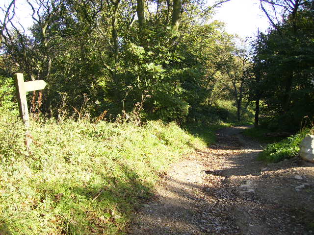
The Cleveland Way near Frank Cliff
The long distance footpath is not where the map shows it at this point having been moved inland by about 60 metres in recent years due to coastal erosion.
 Map © Crown Copyright")
TIP: Click the map for more Large scale mapping
- Grid Square
- TA0586, 126 images (more nearby 🔍)
- Photographer
- Phil Catterall (more nearby)
- Date Taken
- Tuesday, 18 September, 2007 (more nearby)
- Submitted
- Tuesday, 18 September, 2007
- Subject Location
-
OSGB36:
 TA 05730 86108 [1m precision]
WGS84: 54:15.5834N 0:22.7029W - Camera Location
-
OSGB36: TA 05716 86076
- View Direction
- North-northeast (about 22 degrees)