1967
SP3379 : Looking north from Priory Hall, 1967
taken 57 years ago, near to Coventry, England
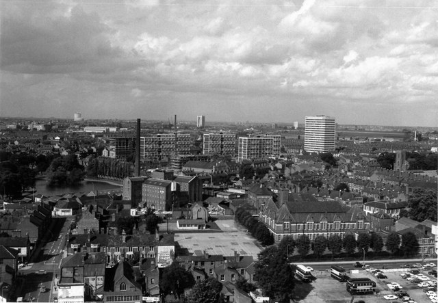
Looking north from Priory Hall, 1967
Taken from the top of the then new Priory Hall (for a view of the building see SP3379 : Priory Hall, Priory Street, Coventry ). On the left Priory Street runs towards Swanswell Pool. Ford Street is seen running left to right between the buses and Wheatley Street School. The rear of the Welsh Presbyterian Church can be seen in the middle of the terrace at the bottom of the photo, and the flour mills in the centre of the view. Longford Gas Works can be seen on the horizon. All the buildings in the foreground were demolished shortly afterwards to make way for the ring road.
 Map © Crown Copyright")
TIP: Click the map for more Large scale mapping
- Grid Square
- SP3379, 1833 images (more nearby 🔍)
- Photographer
- Richard Warren (more nearby)
- Contributed by
- John Brightley (more nearby)
- Date Taken
- 16 August 1967 (more nearby)
- Submitted
- Monday, 13 November, 2017
- Subject Location
-
OSGB36:
 SP 3374 7931 [10m precision]
WGS84: 52:24.6455N 1:30.3247W - Camera Location
-
OSGB36: SP 3369 7907
- View Direction
- NORTH (about 0 degrees)