2017
SC3170 : Port Grenaugh and surrounding coastline
taken 6 years ago, 3 km from Newtown, Isle of Man
This is 1 of 7 images, with title starting with Port in this square
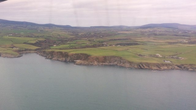
Port Grenaugh and surrounding coastline
On approach to Ronaldsway from Liverpool.
The streaks are unfortunately condensation marks on the outside of the cabin.
To the immediate right is Meary Voar a recently built private house built on an old existing farmhouse site with its surrounding outbuildings
The streaks are unfortunately condensation marks on the outside of the cabin.
To the immediate right is Meary Voar a recently built private house built on an old existing farmhouse site with its surrounding outbuildings
 Map © Crown Copyright")
TIP: Click the map for more Large scale mapping
- Grid Square
- SC3170, 17 images (more nearby 🔍)
- Photographer
- Richard Hoare (more nearby)
- Date Taken
- Friday, 3 November, 2017 (more nearby)
- Submitted
- Tuesday, 14 November, 2017
- Subject Location
-
OSGB36:
 SC 31610 70464 [1m precision]
WGS84: 54:6.1457N 4:34.6147W - View Direction
- North-northwest (about 337 degrees)