2017
NS1381 : The widened B836
taken 7 years ago, near to Sandhaven, Argyll And Bute, Scotland
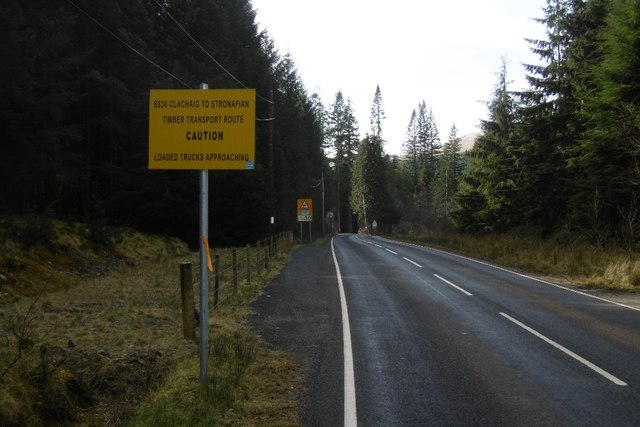
The widened B836
The road has been upgraded east of Clachaig. The yellow sign warns of timber lorries. Lots of logs come out of the forests here to be shipped out of the Holy Loch.
 Map © Crown Copyright")
TIP: Click the map for more Large scale mapping
- Grid Square
- NS1381, 24 images (more nearby 🔍)
- Photographer
- Richard Webb (more nearby)
- Date Taken
- Sunday, 26 March, 2017 (more nearby)
- Submitted
- Wednesday, 15 November, 2017
- Subject Location
-
OSGB36:
 NS 1341 8151 [10m precision]
WGS84: 55:59.4096N 4:59.5804W - Camera Location
-
OSGB36: NS 1343 8154
- View Direction
- South-southwest (about 202 degrees)