2016
TL1011 : Old Milestone, A5183, St Albans Road, Redbourn
taken 8 years ago, near to Redbourn, Hertfordshire, England
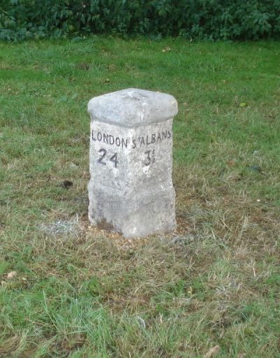
Old Milestone, A5183, St Albans Road, Redbourn
The milestone is located at the roundabout at the junction with High Street, on the green on the west side of road. Parish of Redbourn (St Albans District). Carved stone post, Dunstable stone design, erected by the Dunstable Turnpike Trust in the 19th century. According to old OS maps, the milestone was originally located further south down the road on the east side at TL 1105 1174
Inscription reads:-
LONDON / 24 : : ST ALBANS / 3½
Milestone Society National ID: HE_LH24
Inscription reads:-
LONDON / 24 : : ST ALBANS / 3½
Milestone Society National ID: HE_LH24
National Survey of Wayside Features by The Milestone Society
These images are from Link
 Map © Crown Copyright")
TIP: Click the map for more Large scale mapping
- Grid Square
- TL1011, 50 images (more nearby 🔍)
- Photographer
- Milestone Society (more nearby)
- Date Taken
- Saturday, 1 October, 2016 (more nearby)
- Submitted
- Saturday, 18 November, 2017
- Subject Location
-
OSGB36:
 TL 1093 1191 [10m precision]
WGS84: 51:47.6910N 0:23.5727W - Camera Location
-
OSGB36: TL 1093 1191
- View Direction
- West-northwest (about 292 degrees)