2017
SU9209 : Halnaker Hill WWII RDF station - HFDF #4
taken 6 years ago, near to Eartham, West Sussex, England
This is 1 of 2 images, with title Halnaker Hill WWII RDF station - HFDF #4 in this square
Halnaker Hill WWII RDF station - HFDF #4
-
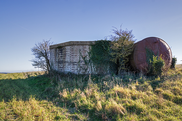
RDF Tower: DoB ID: S0007661
The fourth HFDF site is at the northern extremity of the enclosure, and it too is very overgrown. It's not possible to see inside, but past examination has revealed it has the same octagonal base as all the others. It differs however in that post war it seems to have found a use as a reservoir, with a large water tank sited adjacent to it, and its brick blast wall has been capped with a concrete roof.
SU9209 : Halnaker Hill WWII RDF station - HFDF #4
 Map © Crown Copyright")
TIP: Click the map for more Large scale mapping
- Grid Square
- SU9209, 56 images (more nearby 🔍)
- Photographer
- Mike Searle (more nearby)
- Date Taken
- Friday, 17 November, 2017 (more nearby)
- Submitted
- Saturday, 18 November, 2017
- Subject Location
-
OSGB36:
 SU 9206 0981 [10m precision]
WGS84: 50:52.8276N 0:41.5668W - Camera Location
-
OSGB36: SU 9206 0982
- View Direction
- SOUTH (about 180 degrees)