2017
ST7733 : Iron Bridge, Stourhead Gardens
taken 6 years ago, near to Stourton, Wiltshire, England
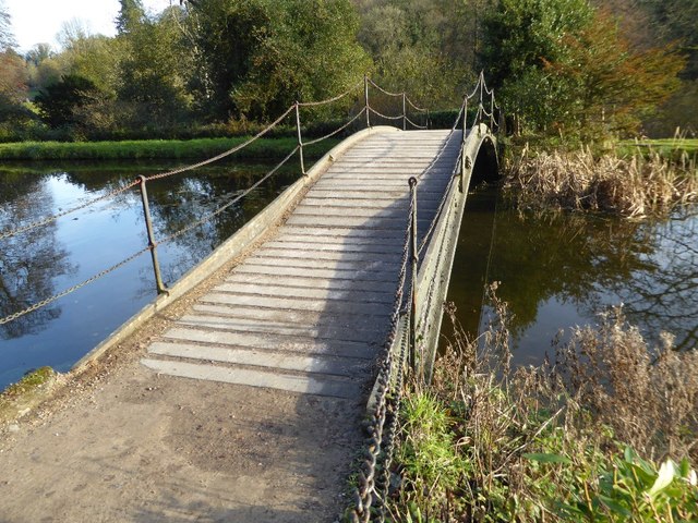
Iron Bridge, Stourhead Gardens
The Iron Bridge dates from 1860 and was made by the foundry of Maggs and Hindley, it replaced an early oak bridge of 1840. The bridge spans the western arms of the Garden lake and was erected for Henry Ainslie Hoare, 5th Baronet. The Bridge is Grade II listed. Link
 Map © Crown Copyright")
TIP: Click the map for more Large scale mapping
- Grid Square
- ST7733, 450 images (more nearby 🔍)
- Photographer
- Philip Halling (more nearby)
- Date Taken
- Friday, 17 November, 2017 (more nearby)
- Submitted
- Sunday, 19 November, 2017
- Subject Location
-
OSGB36:
 ST 7705 3385 [10m precision]
WGS84: 51:6.2092N 2:19.7498W - Camera Location
-
OSGB36: ST 7706 3385
- View Direction
- West-northwest (about 292 degrees)