2017
ST7635 : St Peter's Pump
taken 6 years ago, near to Kilmington Common, Wiltshire, England
This is 1 of 5 images, with title St Peter's Pump in this square
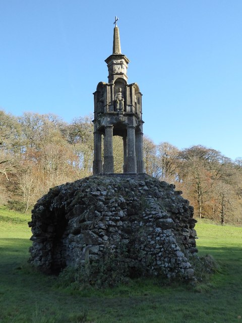
St Peter's Pump
St Peter's Pump at Stourhead marks the source of the River Stour. Formerly it was known as the Well of St Edith and was situated in Bristol, it was moved to its present location in 1768 for Henry Hoare. It is Grade I listed. Link
 Map © Crown Copyright")
TIP: Click the map for more Large scale mapping
- Grid Square
- ST7635, 34 images (more nearby 🔍)
- Photographer
- Philip Halling (more nearby)
- Date Taken
- Friday, 17 November, 2017 (more nearby)
- Submitted
- Monday, 20 November, 2017
- Subject Location
-
OSGB36:
 ST 7609 3539 [10m precision]
WGS84: 51:7.0377N 2:20.5786W - Camera Location
-
OSGB36: ST 7608 3538
- View Direction
- Northeast (about 45 degrees)