2017
SS9497 : Zigzag road markings outside Penyrenglyn Community Primary School
taken 6 years ago, near to Treherbert, Rhondda Cynon Taf, Wales
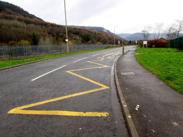
Zigzag road markings outside Penyrenglyn Community Primary School
The yellow markings define the Keep Clear Zone (no parking or stopping) outside this Link school.
 Map © Crown Copyright")
TIP: Click the map for more Large scale mapping
- Grid Square
- SS9497, 141 images (more nearby 🔍)
- Photographer
- Jaggery (more nearby)
- Date Taken
- Tuesday, 21 November, 2017 (more nearby)
- Submitted
- Thursday, 23 November, 2017
- Subject Location
-
OSGB36:
 SS 9445 9769 [10m precision]
WGS84: 51:40.0823N 3:31.6577W - Camera Location
-
OSGB36: SS 9448 9767
- View Direction
- West-northwest (about 292 degrees)