2017
NO7393 : Field boundaries south of Cairnshee Wood
taken 6 years ago, near to Blairydryne, Aberdeenshire, Scotland
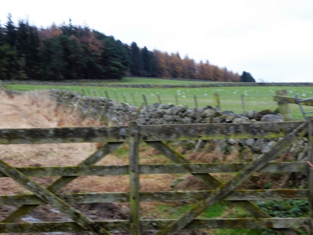
Field boundaries south of Cairnshee Wood
And west of Standing Stones farmstead. Dry stone walls seen from the minor road, over a 5-bar wooden gate.
 Map © Crown Copyright")
TIP: Click the map for more Large scale mapping
- Grid Square
- NO7393, 19 images (more nearby 🔍)
- Photographer
- Stanley Howe (more nearby)
- Date Taken
- Tuesday, 14 November, 2017 (more nearby)
- Submitted
- Saturday, 25 November, 2017
- Subject Location
-
OSGB36:
 NO 7375 9319 [10m precision]
WGS84: 57:1.7439N 2:26.0442W - Camera Location
-
OSGB36: NO 7364 9307
- View Direction
- Northeast (about 45 degrees)