2017
SK3173 : Oxton Rake Road
taken 7 years ago, near to Moorhall, Derbyshire, England
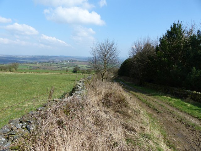
Oxton Rake Road
Green lane (Barlow bridleway 12) leaves the B6050 and heads ENE to Oxton Rakes. The boundary between Barlow (left) and Brampton (right) parishes runs along the track. The small triangular plantation on the right is not marked on the OS map.
 Map © Crown Copyright")
TIP: Click the map for more Large scale mapping
- Grid Square
- SK3173, 47 images (more nearby 🔍)
- Photographer
- Dave Dunford (more nearby)
- Date Taken
- Thursday, 23 March, 2017 (more nearby)
- Submitted
- Saturday, 25 November, 2017
- Subject Location
-
OSGB36:
 SK 3191 7358 [10m precision]
WGS84: 53:15.4962N 1:31.3876W - Camera Location
-
OSGB36: SK 3187 7357
- View Direction
- East-northeast (about 67 degrees)