2016
NZ3276 : Seaton Delaval Hall from the east
taken 8 years ago, near to Seaton, Northumberland, England
This is 1 of 4 images, with title starting with Seaton Delaval Hall from the in this square
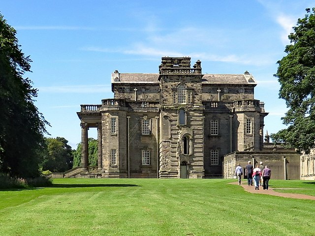
Seaton Delaval Hall from the east
Seaton Delaval Hall is a Grade I listed country house (List entry Number: 1041321). It stands near the coast between Seaton Sluice and Seaton Delaval. It was designed by Sir John Vanbrugh in 1718 for Admiral George Delaval and is now owned by the National Trust.
Both Vanbrugh and Admiral Delaval died before the house was completed. The west wing was damaged by fire in 1752 but restored 1814-15 by John Dobson; the main block was similarly gutted in 1822 and although re-roofed, remains largely an empty shell.
Historic England: Link
National Trust: Link
Wikipedia: Link
See other images of Seaton Delaval Hall
 Map © Crown Copyright")
TIP: Click the map for more Large scale mapping
- Grid Square
- NZ3276, 139 images (more nearby 🔍)
- Photographer
- Andrew Curtis (more nearby)
- Date Taken
- Saturday, 16 July, 2016 (more nearby)
- Submitted
- Monday, 27 November, 2017
- Subject Location
-
OSGB36:
 NZ 3224 7653 [10m precision]
WGS84: 55:4.9305N 1:29.7911W - Camera Location
-
OSGB36: NZ 3236 7657
- View Direction
- West-southwest (about 247 degrees)