2017
TQ4080 : Royal Victoria Dock
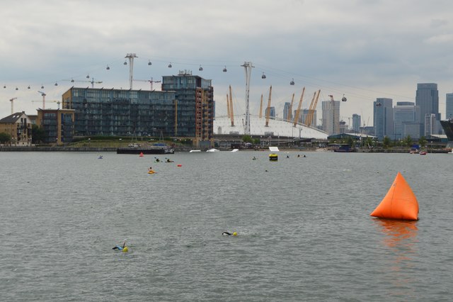
taken 7 years ago, near to Blackwall Tunnel, Greenwich, England
This is 1 of 101 images, with title Royal Victoria Dock in this square
Royal Victoria Dock
The Royal Victoria Dock opened in 1855 it was the first of the Royal Docks and the first London dock to be designed specifically to accommodate large steam ships. It was also the first to use hydraulic power to operate its machinery and the first to be connected to the national railway network.
The Royal Victoria Dock consisted of a main dock and a basin to the west, providing an entrance to the Thames on the western side of the complex.
The dock was an immediate commercial success, as it could easily accommodate all but the very largest steamships. It was badly damaged by German bombing in World War II but experienced a resurgence in trade following the war. However, from the 1960s onwards, the Royal Victoria experienced a steady decline as the shipping industry adopted containerization, which effectively moved traffic downstream to Tilbury. It finally closed to commercial traffic along with the other Royal Docks in 1980.
Since the 1980s the area around the dock has been redeveloped, including the ExCel Centre.
See other images of Royal Victoria Dock
 Map © Crown Copyright")
TIP: Click the map for more Large scale mapping
- Grid Square
- TQ4080, 1217 images (more nearby 🔍)
- Photographer
- N Chadwick (more nearby)
- Date Taken
- Saturday, 1 July, 2017 (more nearby)
- Submitted
- Monday, 4 December, 2017
- Subject Location
-
OSGB36:
 TQ 4025 8054 [10m precision]
WGS84: 51:30.3837N 0:1.1668E - Camera Location
-
OSGB36: TQ 4052 8065
- View Direction
- West-southwest (about 247 degrees)