2017
SK7518 : Burton Street Vicinity, Melton Mowbray, Leics
taken 6 years ago, near to Melton Mowbray, Leicestershire, England
This is 1 of 2 images, with title Burton Street Vicinity, Melton Mowbray, Leics. in this square
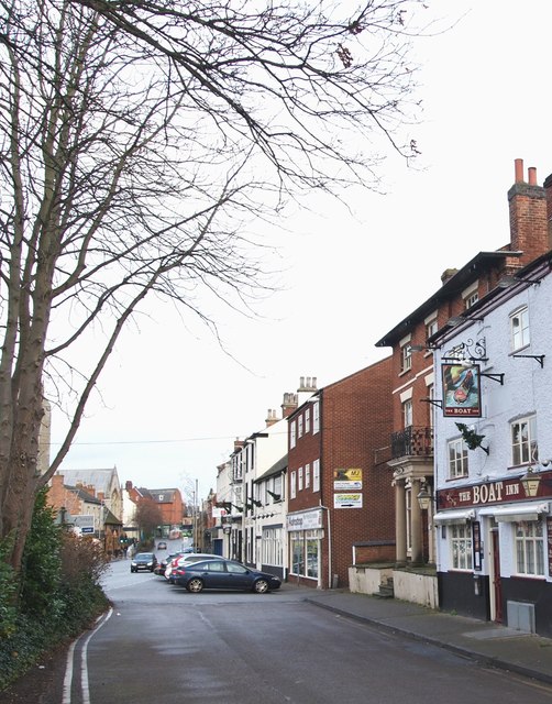
Burton Street Vicinity, Melton Mowbray, Leics.
The Oakham Canal was opened in 1802. From a nearby canal basin that has now disappeared, the canal followed the valley of the River Eye to Saxby before reaching a wharf that became Station Cottages (site of the former Whissendine railway station) and then continued to Edmondthorpe and Market Overton and south to the Ashwell/Cottesmore Road before reaching the Oakham canal basin. It seems that the canal was a financial success, especially during its last 10 years of operation, carrying some 30,000 tons of freight (mainly coal) in 1846. The canal closed in 1847 having been sold to the Midland Railway Company to allow the construction of the Syston and Peterborough railway. Parts of the canal remain in existence today as part of the landscape, with several sections still being water-filled, although the connection with the Melton Mowbray Navigation has been severed. Both canal basins, and the areas east of the Melton Mowbray canal basin and north of the Oakham canal basin, have been redeveloped. This pub seems likely to have served the needs of those working on the now long gone wharves. The town centre lies ahead.
 Map © Crown Copyright")
TIP: Click the map for more Large scale mapping
- Grid Square
- SK7518, 690 images (more nearby 🔍)
- Photographer
- David Hallam-Jones (more nearby)
- Date Taken
- Sunday, 3 December, 2017 (more nearby)
- Submitted
- Monday, 4 December, 2017
- Subject Location
-
OSGB36:
 SK 7539 1886 [10m precision]
WGS84: 52:45.7256N 0:53.0527W - Camera Location
-
OSGB36: SK 7539 1884
- View Direction
- North-northwest (about 337 degrees)