2017
NU0641 : Lane to Bunters Knowe
taken 6 years ago, near to West Mains, Northumberland, England
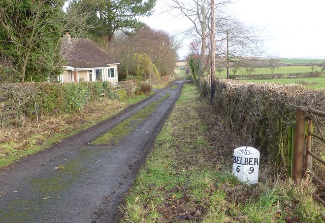
Lane to Bunters Knowe
The mile indicator is now some way from the A1 but indicates 9 miles to Berwick, 6 miles from Belford and 325 miles to London.
 Map © Crown Copyright")
TIP: Click the map for more Large scale mapping
- Grid Square
- NU0641, 41 images (more nearby 🔍)
- Photographer
- Russel Wills (more nearby)
- Date Taken
- Tuesday, 5 December, 2017 (more nearby)
- Submitted
- Tuesday, 5 December, 2017
- Subject Location
-
OSGB36:
 NU 0605 4128 [10m precision]
WGS84: 55:39.8998N 1:54.3235W - Camera Location
-
OSGB36: NU 06050 41285
- View Direction
- North-northeast (about 22 degrees)