2006
NZ1244 : Old Milestone by the B6296, north east of Satley
taken 18 years ago, near to Satley, County Durham, England
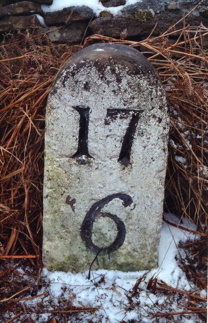
Old Milestone by the B6296, north east of Satley
Carved stone post by the B6296, in parish of SATLEY (DERWENTSIDE District), 170m North of Hall Hill Farm, on grass verge, on North side of road. Durham numbers stone, erected by the Lobley Hill & branches turnpike trust in the 18th century.
Inscription reads:-
17
6
(To Newcastle and Wolsingham)
Grade II Listed. List Entry Number:1185996
Link
Milestone Society National ID: DU_GHWO17.
Inscription reads:-
17
6
(To Newcastle and Wolsingham)
Grade II Listed. List Entry Number:1185996
Link
Milestone Society National ID: DU_GHWO17.
National Survey of Wayside Features by The Milestone Society
These images are from Link
 Map © Crown Copyright")
TIP: Click the map for more Large scale mapping
- Grid Square
- NZ1244, 13 images (more nearby 🔍)
- Photographer
- IA Davison (more nearby)
- Contributed by
- Milestone Society (more nearby)
- Date Taken
- Thursday, 16 March, 2006 (more nearby)
- Submitted
- Sunday, 10 December, 2017
- Subject Location
-
OSGB36:
 NZ 12582 44274 [1m precision]
WGS84: 54:47.5920N 1:48.3506W - Camera Location
-
OSGB36: NZ 12582 44274
- View Direction
- Northwest (about 315 degrees)