NS4278 : Old boundary
taken 6 years ago, 3 km from Bonhill, West Dunbartonshire, Scotland
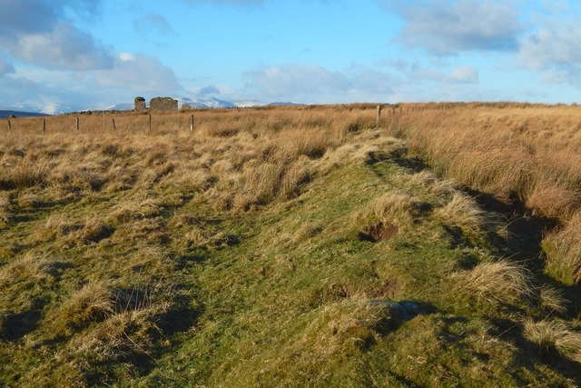
The NS4278 : Ruins of Auchenreoch are about 110 metres ahead. The snow-covered hills behind the ruin and to the right of it are those around Glen Finlas.
This ruined farmstead is shown on the first-edition OS map (c.1860). At one time, it may have been part of a more extensive ferm toun. The OS Object Name Books describe it as "a shepherd's house in Auchenreoch Muir".
In the Register of the Great Seal, Auchenreoch is mentioned, as "Auchinreoch", in a Latin charter by James VI, dated 13 Dec 1609, along with several other recognisable place-names from nearby [charter #190 in Volume 8 of RMS]. The 1654 Blaeu map of the Lennox shows it, as "Achrioch", near two other farms that are still in existence, namely, "Headdycks" (Highdykes Farm) and "Morehauch" (Murroch Farm).
The "reoch" element of the name is probably from Gaelic "riabhach" (meaning "variegated", "striped"): see Simon Taylor's remarks in the book "Changing Identities Ancient Roots". The moor is dissected by many parallel glens, tributaries of Murroch Glen, so that it appears striped from a distance.
Auchenreoch is mentioned a few times in Dumbarton's Common Good accounts. Of two entries made in 1614/15, one is about taxation not received ("for Auchenreoch, fourtie twa s[hillings]"), while the other entry is the terse "item the commoun of Auchinreoch".
A stent roll drawn up in 1643 contains the following entry: "The Laird of Fullwod for his landis of Kilmalid, Achinreoche, Milne and Milne landis". The Laird referred to here is Semple of Fullwood. The name Kilmalid also survives (the farm of that name survived into the twentieth century, and was located at NS39627737).
As well as the ruined buildings of Auchenreoch themselves, various related features are prominent on the ground and in satellite imagery: old field dykes and the remains of cultivated plots with their patterns of ridges intact.
 Map © Crown Copyright")
- Grid Square
- NS4278, 100 images (more nearby 🔍)
- Photographer
- Lairich Rig (more nearby)
- Date Taken
- Friday, 8 December, 2017 (more nearby)
- Submitted
- Saturday, 16 December, 2017
- Subject Location
-
OSGB36:
 NS 4254 7865 [10m precision]
WGS84: 55:58.4962N 4:31.4925W - Camera Location
-
OSGB36: NS 4256 7863
- View Direction
- Northwest (about 315 degrees)