2017
ST5672 : Brunel Way Pump Track
taken 7 years ago, near to Leigh Woods, North Somerset, England
This is 1 of 7 images, with title starting with Brunel Way in this square
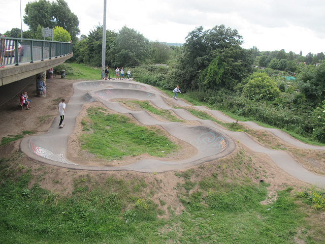
Brunel Way Pump Track
I take the name of this feature from Google Maps. I would have called it a skateboard park, but terminology changes and this one is new to me. Wikipedia defines a "pump track" as "a type of off-road terrain for cycle sport consisting of a circuit of banked turns and features designed to be ridden completely by riders "pumping" - creating momentum by up and down body movements."
 Map © Crown Copyright")
TIP: Click the map for more Large scale mapping
- Grid Square
- ST5672, 918 images (more nearby 🔍)
- Photographer
- Stephen Craven (more nearby)
- Date Taken
- Sunday, 25 June, 2017 (more nearby)
- Submitted
- Monday, 25 December, 2017
- Subject Location
-
OSGB36:
 ST 5669 7207 [10m precision]
WGS84: 51:26.7571N 2:37.4752W - Camera Location
-
OSGB36: ST 5669 7209
- View Direction
- SOUTH (about 180 degrees)