2017
TQ0213 : Drainage Ditch
taken 6 years ago, near to Bury, West Sussex, England
This is 1 of 2 images, with title Drainage Ditch in this square
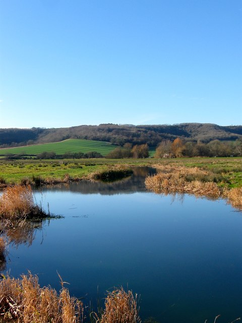
Drainage Ditch
The rather sinuous course of this ditch suggests an old creek was utilised when the land was reclaimed. The ditch separates TQ0212 : Upper Ferry Brook in the south from TQ0213 : New Meadow (1) to the north. In the distance are Bury Hill and Westburton Hill.
 Map © Crown Copyright")
TIP: Click the map for more Large scale mapping
- Grid Square
- TQ0213, 322 images (more nearby 🔍)
- Photographer
- Simon Carey (more nearby)
- Date Taken
- Thursday, 28 December, 2017 (more nearby)
- Submitted
- Friday, 29 December, 2017
- Subject Location
-
OSGB36:
 TQ 0208 1303 [10m precision]
WGS84: 50:54.4635N 0:32.9699W - Camera Location
-
OSGB36: TQ 0213 1303
- View Direction
- WEST (about 270 degrees)