2017
NY3108 : The outflow of Easedale Tarn
taken 6 years ago, 3 km from Grasmere, Cumbria, England
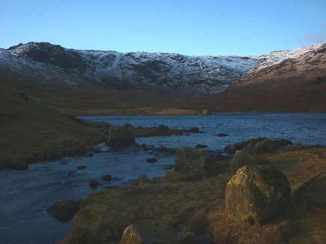
The outflow of Easedale Tarn
Sourmilk (or Sour Milk) Gill flows out of the tarn just as the morning sun is starting to touch its shores. Blea Crag is the dark mass on the snow-covered flank of Blea Rigg beyond the head of the tarn.
 Map © Crown Copyright")
TIP: Click the map for more Large scale mapping
- Grid Square
- NY3108, 57 images (more nearby 🔍)
- Photographer
- Karl and Ali (more nearby)
- Date Taken
- Wednesday, 27 December, 2017 (more nearby)
- Submitted
- Sunday, 31 December, 2017
- Subject Location
-
OSGB36:
 NY 3104 0876 [10m precision]
WGS84: 54:28.1701N 3:3.9321W - Camera Location
-
OSGB36: NY 3104 0876
- View Direction
- West-southwest (about 247 degrees)