2017
SJ3390 : Princes Dock and Alexandra Tower, Liverpool
taken 6 years ago, near to Seacombe, Wirral, England
This is 1 of 18 images, with title starting with Princes Dock in this square
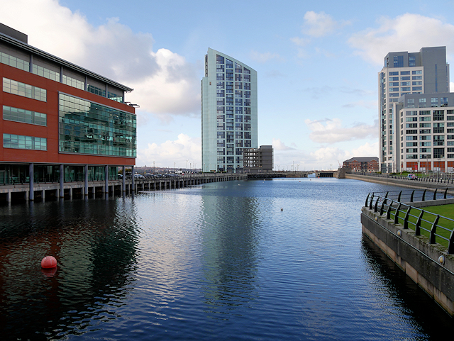
Princes Dock and Alexandra Tower, Liverpool
Princes Dock is part of the Port of Liverpool. It is the most southerly of the docks situated in the northern part of the Liverpool dock system, connected to Princes Half Tide Dock to the north. The dock is now in the buffer zone to one of Liverpool's World Heritage Sites.
Princes Dock was named after the Prince Regent. It opened on the day of the Prince Regent's coronation as George IV in 1821. Access to the southern half of the dock system was via George's Basin, George's Dock and into Canning Dock. In 1899, both George's Basin and George's Dock were filled in to create what is now the Pier Head.
Ferry services from Princes Dock finally ended in November 1981 when P&O Ferries closed their Liverpool - Belfast overnight service. The dock subsequently closed to shipping. Much of Princes Dock's wharfage and warehouse space has been replaced by three blocks of office accommodation along the river front, the 128-room Malmaison hotel and three apartment blocks. The dock was partially filled in to inland canal boat depths precluding deep water vessels and has been divided into two sections spanned by a pedestrian bridge (from where this photo was taken).
 Map © Crown Copyright")
TIP: Click the map for more Large scale mapping
- Grid Square
- SJ3390, 1484 images (more nearby 🔍)
- Photographer
- David Dixon (more nearby)
- Date Taken
- Thursday, 28 December, 2017 (more nearby)
- Submitted
- Monday, 1 January, 2018
- Subject Location
-
OSGB36:
 SJ 336 908 [100m precision]
WGS84: 53:24.6000N 2:59.9941W - Camera Location
-
OSGB36: SJ 337 907
- View Direction
- Northwest (about 315 degrees)