2017
SK4861 : Buttery Lane, Teversal
taken 7 years ago, near to Teversal, Nottinghamshire, England
This is 1 of 6 images, with title Buttery Lane, Teversal in this square
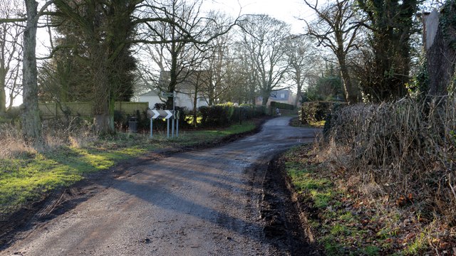
Buttery Lane, Teversal
The photograph shows Buttery Lane on the eastern edge of Teversal. The lane (ahead) becomes a public footpath whilst motor traffic turns to the right.
Both routes are described as Buttery Lane. It would appear that the original route is the one straight ahead whilst the route to the right is a later diversion around the northern edge of the village.
For a photograph of the lane some 200m behind the viewpoint, click here:- SK4861 : Buttery Lane near Teversal and for a photograph of the lane some 100m ahead, click here:- SK4861 : Buttery Lane, Teversal.
 Map © Crown Copyright")
TIP: Click the map for more Large scale mapping
- Grid Square
- SK4861, 106 images (more nearby 🔍)
- Photographer
- Alan Walker (more nearby)
- Date Taken
- Friday, 20 January, 2017 (more nearby)
- Submitted
- Tuesday, 9 January, 2018
- Subject Location
-
OSGB36:
 SK 4850 6188 [10m precision]
WGS84: 53:9.1114N 1:16.5740W - Camera Location
-
OSGB36: SK 4858 6189
- View Direction
- WEST (about 270 degrees)