2018
SX9392 : Gladstone Road, Exeter
taken 6 years ago, near to Exeter, Devon, England
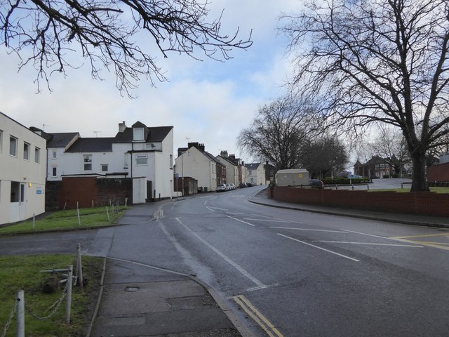
Gladstone Road, Exeter
The road dates from the end of the 19th century. On the left is the ambulance HQ, then the ends of several long Victorian terraces of Exeter's Newtown. Opposite is the car park of the hospital, built beside the Exeter Workhouse
 Map © Crown Copyright")
TIP: Click the map for more Large scale mapping
- Grid Square
- SX9392, 518 images (more nearby 🔍)
- Photographer
- David Smith (more nearby)
- Date Taken
- Saturday, 20 January, 2018 (more nearby)
- Submitted
- Saturday, 20 January, 2018
- Subject Location
-
OSGB36:
 SX 9307 9276 [10m precision]
WGS84: 50:43.4755N 3:30.9770W - Camera Location
-
OSGB36: SX 9305 9272
- View Direction
- North-northeast (about 22 degrees)