2017
H1698 : N13 at Kilross
taken 7 years ago, 4 km S of Drumkeen, Co Donegal, Ireland
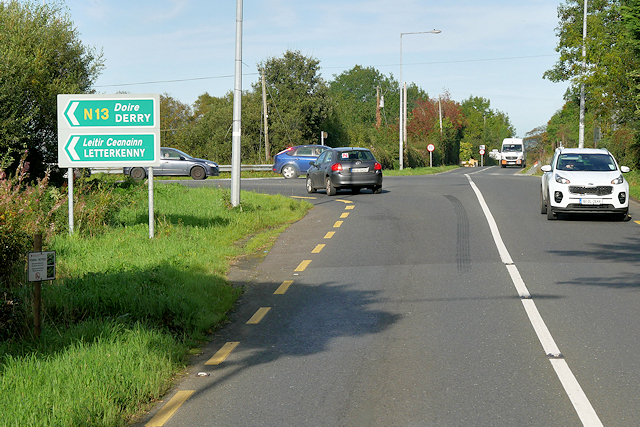
N13 at Kilross
The route north through Kilross includes a T-Junction with the R236 where the N13 turns sharp left.
Irish National Primary Route N13
The N13 is a national primary road in Ireland, running for 44km (27 miles) from Stranorlar to the Northern Ireland border near Derry, where it becomes the A515 before crossing the Foyle Bridge to become the A2.
Loading map... (JavaScript required)
- Grid Square
- H1698, 6 images (more nearby 🔍)
- Photographer
- David Dixon (more nearby)
- Date Taken
- Monday, 25 September, 2017 (more nearby)
- Submitted
- Sunday, 21 January, 2018
- Subject Location
-
Irish:
 H 165 985 [100m precision]
WGS84: 54:50.0901N 7:44.5919W - Camera Location
-
Irish: H 164 985
- View Direction
- Northeast (about 45 degrees)