2017
SE0062 : Medieval terraced field system (3)
taken 6 years ago, near to Linton, North Yorkshire, England
This is 1 of 2 images, with title Medieval terraced field system (3) in this square
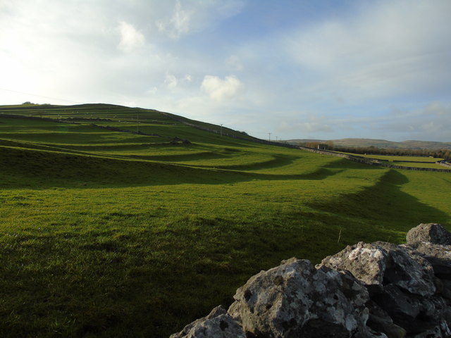
Medieval terraced field system (3)
Taken on the B6160 just below Elbolton Hill, between Thorpe and Linton, North Yorkshire, the low winter sun has brought into sharp relief the former medieval strip ploughing system once prevalent in Wharfedale.
 Map © Crown Copyright")
TIP: Click the map for more Large scale mapping
- Grid Square
- SE0062, 93 images (more nearby 🔍)
- Photographer
- Carroll Pierce (more nearby)
- Date Taken
- Sunday, 31 December, 2017 (more nearby)
- Submitted
- Monday, 22 January, 2018
- Subject Location
-
OSGB36:
 SE 0031 6253 [10m precision]
WGS84: 54:3.5232N 1:59.8054W - Camera Location
-
OSGB36: SE 0079 6258
- View Direction
- WEST (about 270 degrees)