2017
SJ9090 : Scaffolding on the former Rifle Volunteer
taken 7 years ago, near to Bredbury, Stockport, England
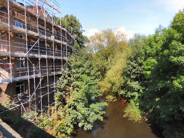
Scaffolding on the former Rifle Volunteer
Looking upstream at the River Goyt from Carrington Road bridge. The former Rifle Volunteer pub which is in the process of being converted into residential accommodation has finally lost its signage and the ivy that grew on the riverside wall SJ9090 : River Goyt by the former Rifle Volunteer.
River Goyt
The Goyt rises on the moors of Axe Edge, near the Cat and Fiddle Inn. It runs from the Errwood and Fernilee reservoirs, north of Buxton to Stockport where it joins the River Tame Link to form the Mersey.
It is also fed by the River Etherow which flows from the Woodhead reservoirs and joins near Marple Bridge, the River Sett which joins at New Mills and Todd Brook which joins at Horwich End.
 Map © Crown Copyright")
TIP: Click the map for more Large scale mapping
- Grid Square
- SJ9090, 260 images (more nearby 🔍)
- Photographer
- Gerald England (more nearby)
- Date Taken
- Thursday, 31 August, 2017 (more nearby)
- Submitted
- Tuesday, 23 January, 2018
- Subject Location
-
OSGB36:
 SJ 9080 9098 [10m precision]
WGS84: 53:24.9326N 2:8.3929W - Camera Location
-
OSGB36: SJ 9081 9097
- View Direction
- North-northwest (about 337 degrees)