2017
TQ2764 : Carshalton Lower Pond
taken 7 years ago, near to Carshalton, Sutton, England
This is 1 of 2 images, with title Carshalton Lower Pond in this square
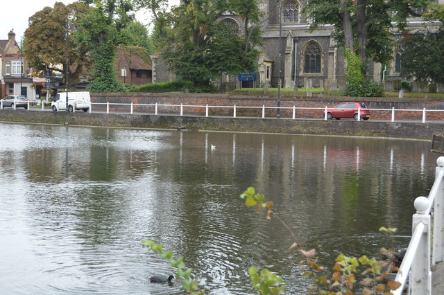
Carshalton Lower Pond
The springs and ponds in the centre of old Carshalton date back for centuries, probably explaining why there was an early Saxon settlement here.
Once a single pond, it was divided into two pools in the 15th century one for the public and one private, for Stone Court and then The Grove, also the source of power for the Upper Mill that ground corn for Carshalton.
There are several listed structures associated with the ponds, including a road bridge, culverts, retaining walls and two buildings.
See other images of Carshalton Ponds
 Map © Crown Copyright")
TIP: Click the map for more Large scale mapping
- Grid Square
- TQ2764, 380 images (more nearby 🔍)
- Photographer
- N Chadwick (more nearby)
- Date Taken
- Wednesday, 23 August, 2017 (more nearby)
- Submitted
- Thursday, 1 February, 2018
- Subject Location
-
OSGB36:
 TQ 2796 6452 [10m precision]
WGS84: 51:21.9203N 0:9.7991W - Camera Location
-
OSGB36: TQ 2793 6455
- View Direction
- Southeast (about 135 degrees)