2017
SN9210 : Sgŵd Isaf Clun-gwyn
taken 7 years ago, 3 km from Ystradfellte, Powys, Wales
This is 1 of 5 images, with title Sgŵd Isaf Clun-gwyn in this square
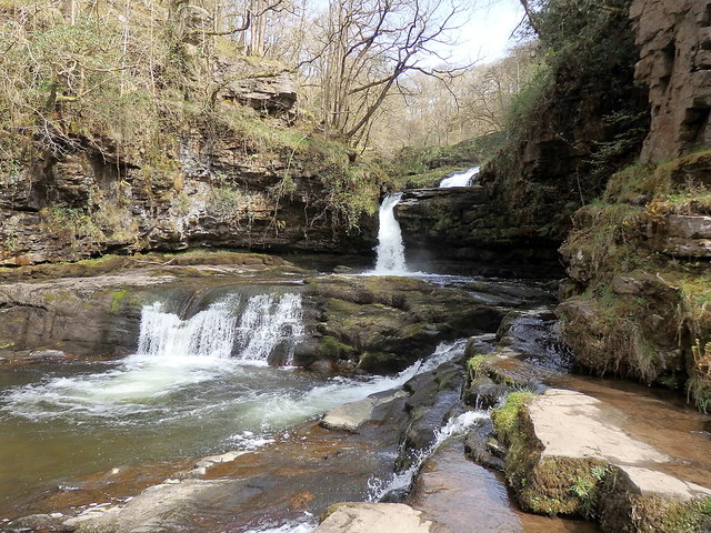
Sgŵd Isaf Clun-gwyn
The waterfall comes in three segments, the middle one being the tallest. The path on the eastern bank climbs down towards the river and gives access to the rocky riverbed at low water levels. There are some footpath diversions in place on safety grounds in this area.
 Map © Crown Copyright")
TIP: Click the map for more Large scale mapping
- Grid Square
- SN9210, 96 images (more nearby 🔍)
- Photographer
- Rudi Winter (more nearby)
- Date Taken
- Tuesday, 11 April, 2017 (more nearby)
- Submitted
- Saturday, 3 February, 2018
- Subject Location
-
OSGB36:
 SN 9235 1060 [10m precision]
WGS84: 51:47.0203N 3:33.7186W - Camera Location
-
OSGB36: SN 9230 1059
- View Direction
- East-northeast (about 67 degrees)