2018
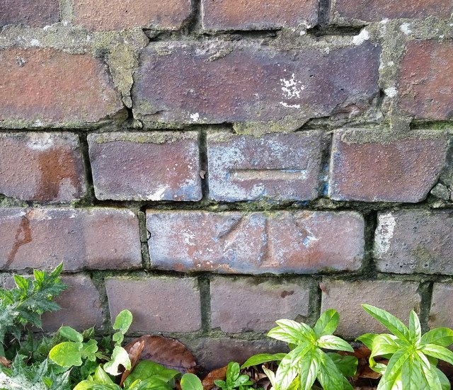
ST1369 : Ordnance Survey Cut Mark
taken 6 years ago, near to Palmerstown, The Vale of Glamorgan/Bro Morgannwg, Wales
This is 1 of 4 images, with title Ordnance Survey Cut Mark in this square
Ordnance Survey Cut Mark
This OS cut mark can be found on west parapet of the bridge. It marks a point 12.582m above mean sea level.
 Map © Crown Copyright")
TIP: Click the map for more Large scale mapping
- Grid Square
- ST1369, 85 images (more nearby 🔍)
- Photographer
- Adrian Dust (more nearby)
- Date Taken
- Saturday, 3 February, 2018 (more nearby)
- Submitted
- Sunday, 4 February, 2018
- Subject Location
-
OSGB36:
 ST 1351 6974 [10m precision]
WGS84: 51:25.2030N 3:14.7134W - Camera Location
-
OSGB36: ST 1351 6974
- View Direction
- West-southwest (about 247 degrees)