2018
SX0380 : Field and parish boundaries near Higher Hendra
taken 6 years ago, near to Pendoggett, Cornwall, England
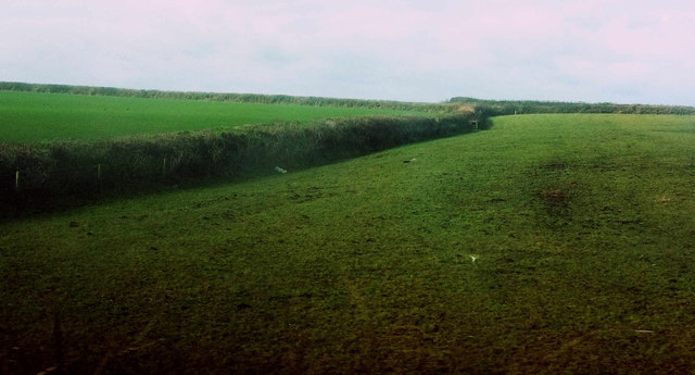
Field and parish boundaries near Higher Hendra
On the left is the parish boundary between St Teath (this side) and St Kew; the further hedge on the left forms the parish boundary between St Kew and St Endellion (beyond it).
 Map © Crown Copyright")
TIP: Click the map for more Large scale mapping
- Grid Square
- SX0380, 7 images (more nearby 🔍)
- Photographer
- Derek Harper (more nearby)
- Date Taken
- Monday, 5 February, 2018 (more nearby)
- Submitted
- Wednesday, 7 February, 2018
- Subject Location
-
OSGB36:
 SX 0330 8051 [10m precision]
WGS84: 50:35.4659N 4:46.8207W - Camera Location
-
OSGB36: SX 0346 8044
- View Direction
- West-northwest (about 292 degrees)