2018
SD6199 : Farmland in the Lune Gorge
taken 6 years ago, near to Lowgill, Cumbria, England
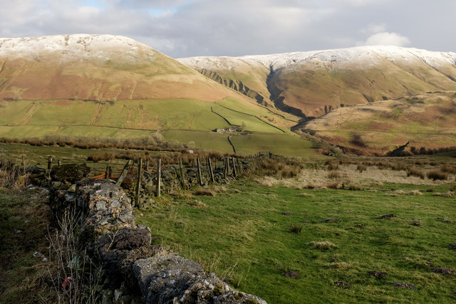
Farmland in the Lune Gorge
In the valley below, but out of sight, are the M6 motorway, the west coast railway line and the River Lune.
 Map © Crown Copyright")
TIP: Click the map for more Large scale mapping
- Grid Square
- SD6199, 24 images (more nearby 🔍)
- Photographer
- Nigel Corby (more nearby)
- Date Taken
- Sunday, 4 February, 2018 (more nearby)
- Submitted
- Friday, 9 February, 2018
- Subject Location
-
OSGB36:
 SD 615 990 [100m precision]
WGS84: 54:23.1448N 2:35.6227W - Camera Location
-
OSGB36: SD 614 990
- View Direction
- East-northeast (about 67 degrees)